The building blocks of a neighborhood are so much more than its physical components: it’s composed of people, culture, and history. For many, like myself, understanding any topic starts with the context—taking stock of what is and what was. And whether you’re new to an area or a long-time resident, there’s a good chance you’ve pondered the origins of a particular building, the story of a beloved park, or the reasoning behind a street name.
When I moved from Portland, Oregon, to St. Louis, Missouri, in 2006, I was struck by the history all around me. Coming from a city with typically newer structures, I was in awe at how old the buildings were. That apartment building was constructed in 1880 and people still live there?! Fascinated from day one, I entrenched myself in it. I wanted to know everything about the building I lived in, the stories of past residents, and what made each of the City’s districts such a distinct and individualized neighborhood.
Lucky for me, I wasn’t alone. The resources available for such research are increasingly available (oftentimes digitally). Depending on where you live and the specific questions you are trying to answer, the starting point of your research may vary. But when the topic is the built environment, I think a great place to start is a map.
The Sanborn Map Company created highly detailed maps of cities and towns across the U.S. from the 1860s to 1970s. Their goal in creating these maps was to assess the total liability of urban areas for fire insurance purposes, but the maps serve as a handy reference point for historical research.
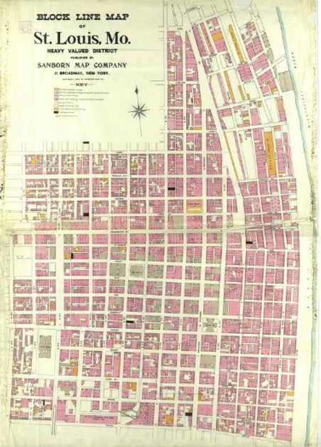
So, what can you discover from these maps? If you’re looking into a specific building, you may be able to pinpoint its construction date. If the home appears on the 1904 map but not on the 1903 one, voila! Your home was built in 1904. You may also see accessory structures, porches, or additions from years long since gone, or past occupants you wish were still around.
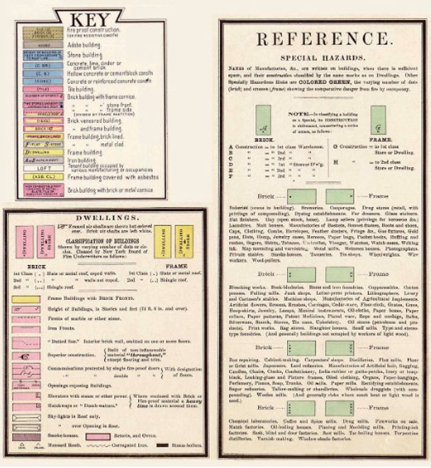
You may also see how the boundaries and landmarks of neighborhoods have been shaped over time. Is your neighborhood currently separated from another by a highway? Check what was there before the highway’s construction and imagine how the continuity between the two may have meant different things for the people that lived there.
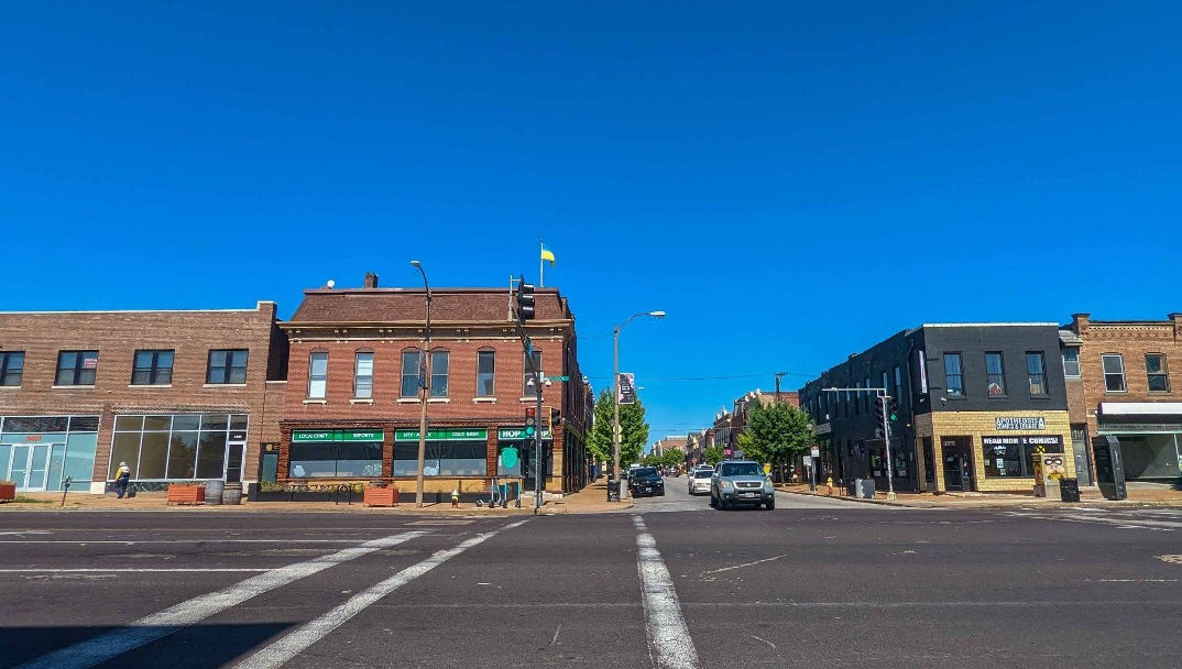
Looking west on Cherokee Street, 3401-11 S. Jefferson Avenue at left
As an example, the shared office space that I work out of (Nebula) is located on the second and third floors of 3401-11 S. Jefferson Avenue in St. Louis. Here’s a look at that area as depicted on the fire insurance maps.
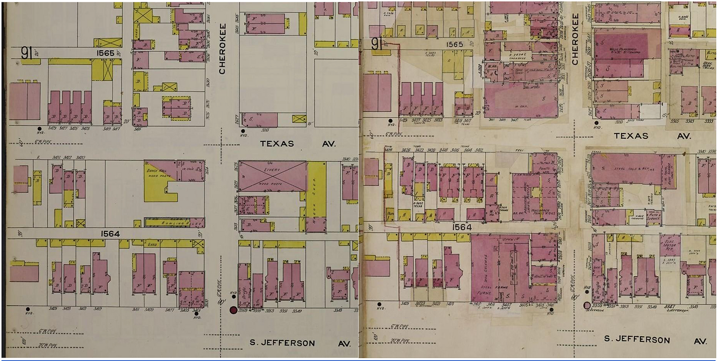
The 1909 version shows a City less built out, while the same map as amended in 1950 looks more familiar. The relative age of the buildings are apparent in the comparison, as are modifications made over time. Much remains the same and much has changed. Though I’d be lying if I said I wasn’t bummed that the bowling alley and dance hall of 1909 aren’t still around!
The Library of Congress has an impressive digital collection of these maps for a wide range of states and counties. Depending on your location, a local university or library may have their own reference material. In Missouri, for example, the Missouri University has its own extensive digital collection, including Sanborn maps.
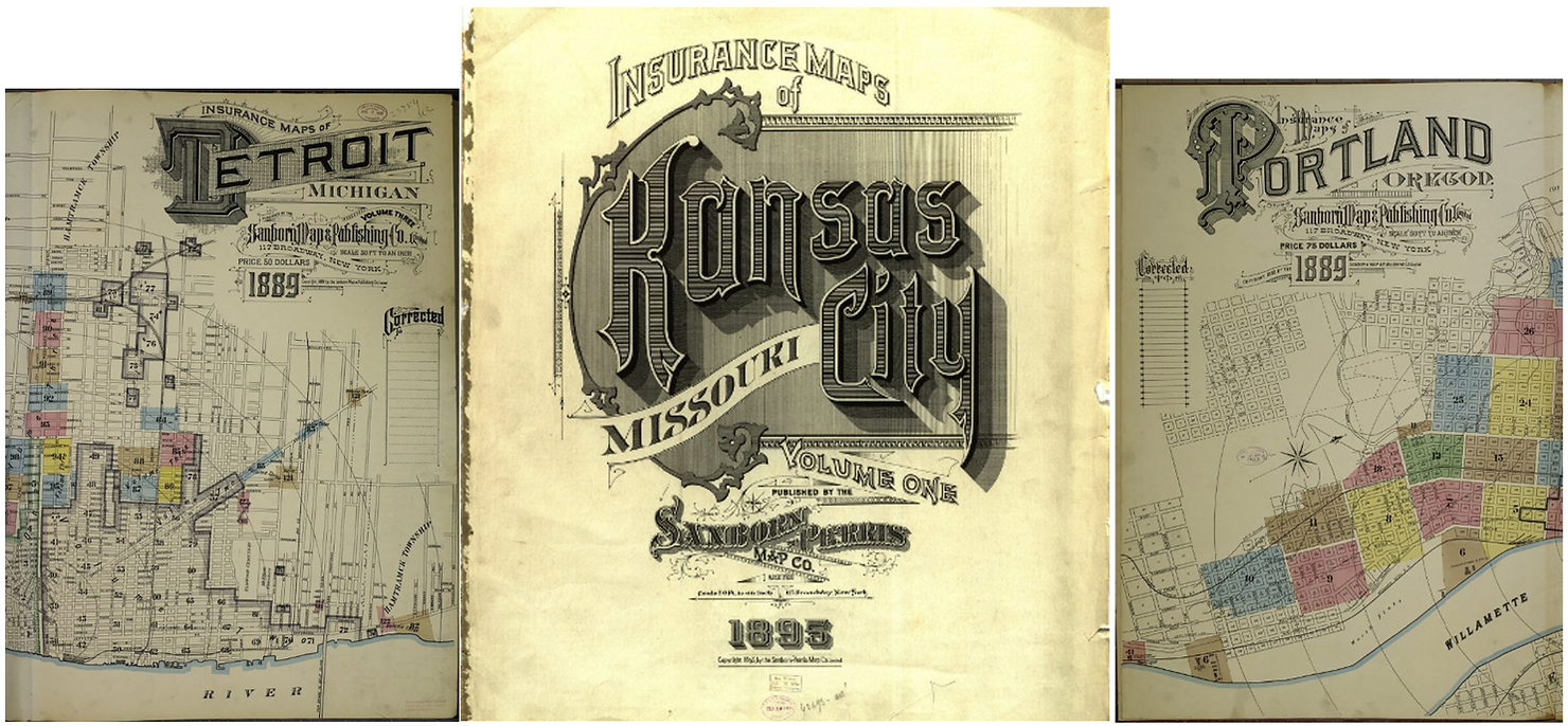
Research aside, these maps are also a captivating example of form meeting function in the early 20th century. They are as detailed as they are beautiful; the typography alone is swoon-worthy and has inspired numerous blogs, typefaces, and books.
When taking time to learn more, it’s easy to discover the many neighborhood gifts all around us! What tools or methods have you used to discover more about the built environment of your neighborhood?
0 Comments